

Services
Professional 3D surveying, scanning and data processing services will help you get an accurate representation of your physical environment in 3D or 2D.
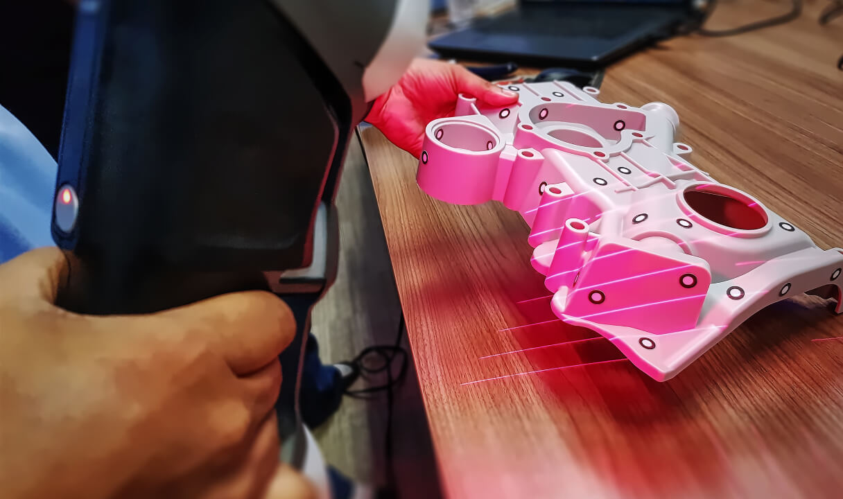
3D laser scanning
3D laser scanning allows precise measurements of an object to be taken in a very short time, which, when transferred to the digital environment, can be used to create a fully accurate 3D model of the object. The model can then be processed and used as the customer requires.
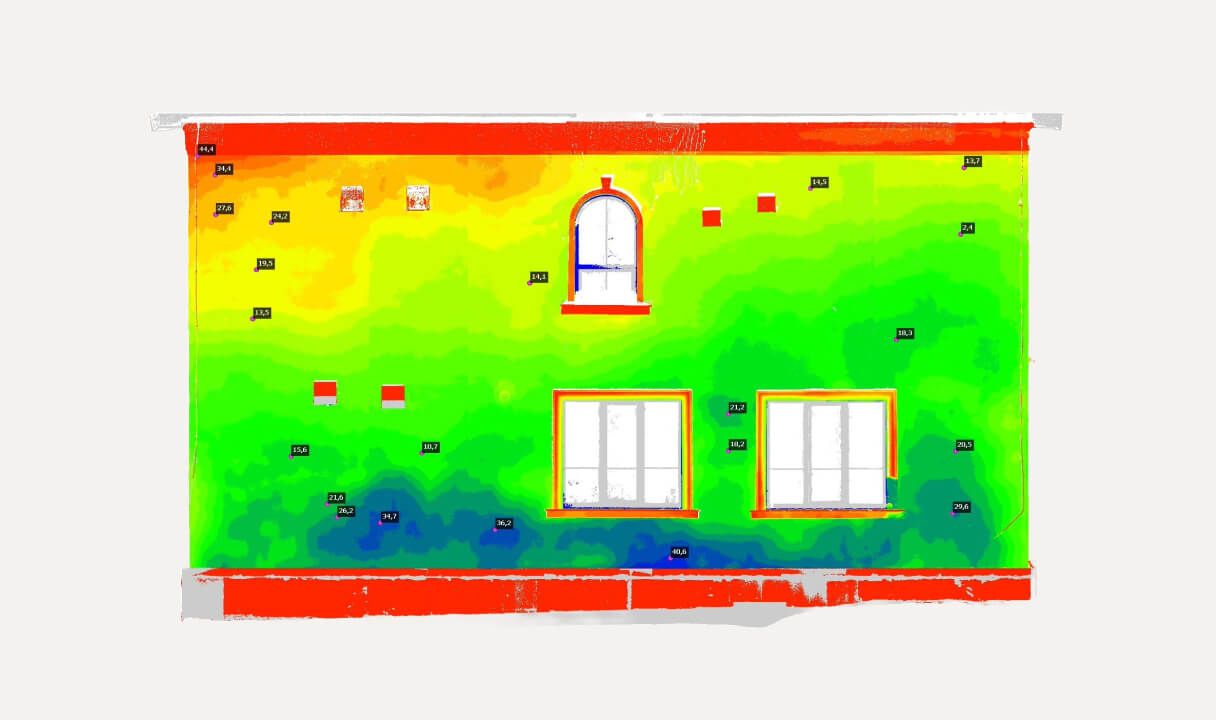
Deformation analysis
Deformation analysis allows the identification of deficiencies in the object before it is completed and their timely correction. It is used in construction, engineering, manufacturing and elsewhere to determine whether structures have changed due to various factors.
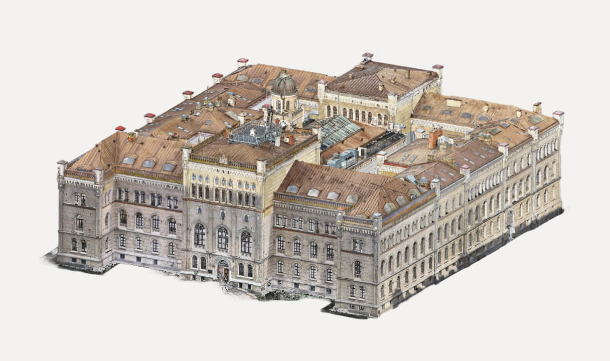
3D modelling
3D modelling allows you to create accurate 1:1 models of the real object. The models are then often used in construction, architecture and other applications to speed up project progress and eliminate potential defects.
Photogrammetry
Photogrammetry uses hundreds to thousands of photographs from different angles, which are then combined together to create a 3D model. A drone is used to capture an object from the air, or an ultra-high-resolution camera is used to capture it on the ground.
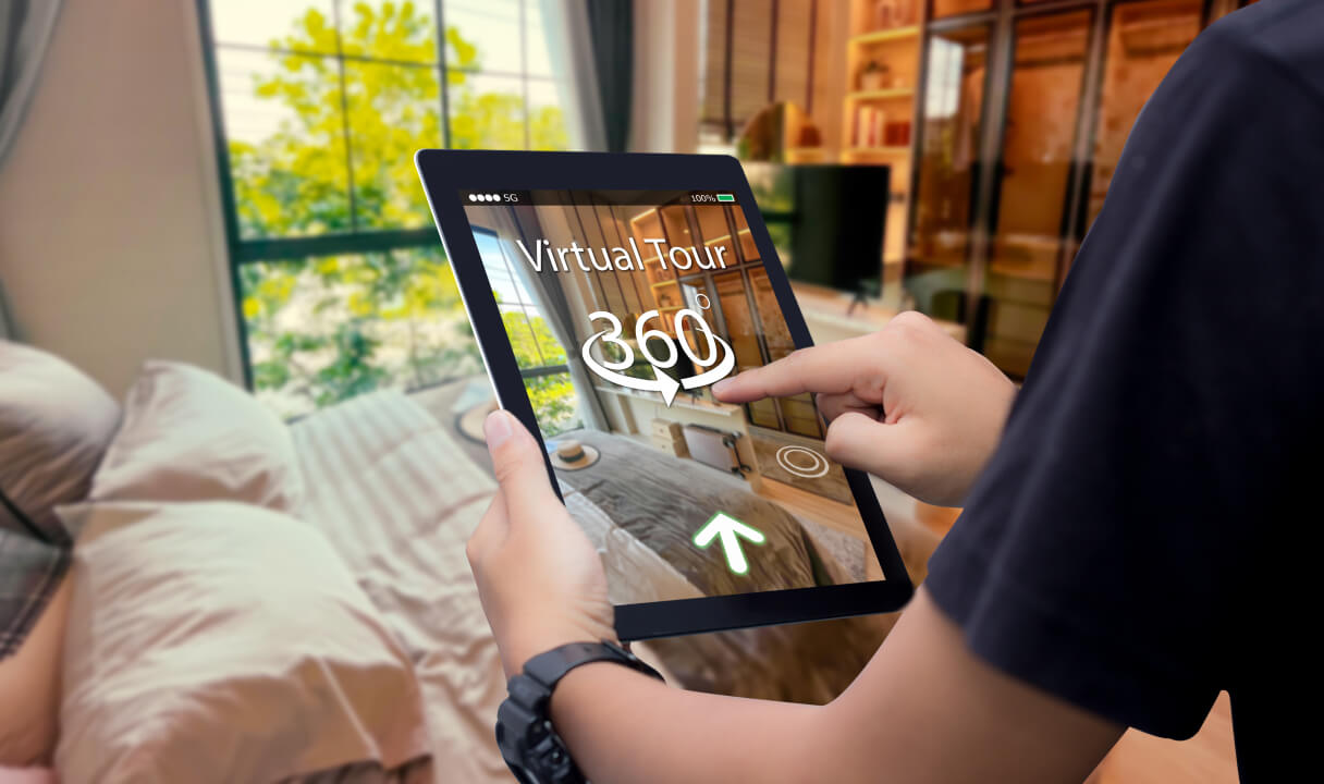
360 virtual tours
360 virtual tours are a way to explore places remotely. It is a video representation of a physical place that the user can control just like in a computer game - moving around and looking around just like in real life. Such tours are used in marketing, presentations, education and more.
Reverse engineering
Using reverse engineering, we can obtain an accurate three-dimensional model even if the physical scan is incomplete. Reverse engineering is used to understand and document existing products, make improvements or reproduce them in a virtual environment.
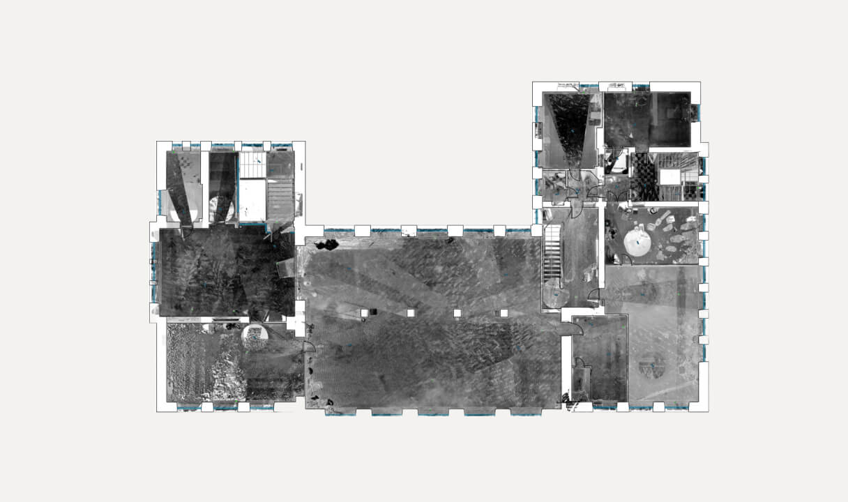
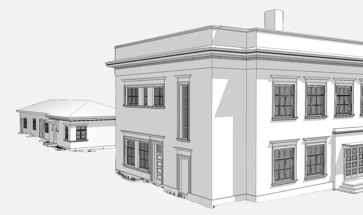
2D technical drawings
We offer the creation of 2D drawings from 3D models. 2D drawings can be used to show detailed measurements, various planes and views, as well as the project specification. This method is widely used in architecture to represent building plans and sections.
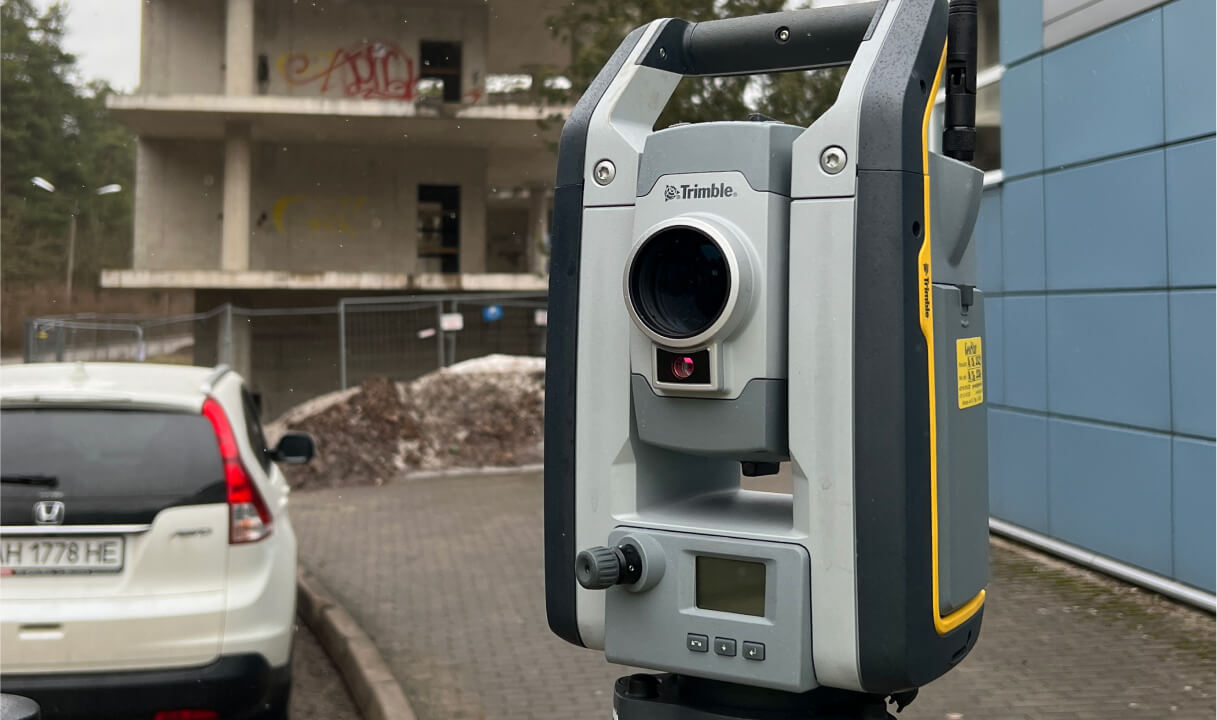
Surveying
Surveying is the discipline of measuring and mapping the earth's surface and other natural or man-made objects. It is widely used in various industries such as construction and engineering, land administration and others.

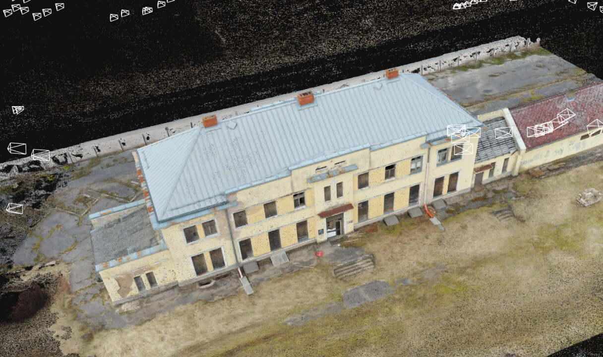
Aerial surveying
Aerial surveys can be used to produce accurate 3D models over large areas. The drone scans the area or takes photos. Aerial surveying is widely used in mapping and topography, geodesy, urban planning and development, and more.
Find out how we can help, book a consultation!
If you have any questions or would like to know more about our services, book a free consultation!