State-of-the-art 3D digital solutions
Tekto enables the conversion of physical objects into digital 3D or 2D formats. Thanks to us, customers receive accurate data and models that match the real environment, making it easier to work in a variety of industries such as construction, restoration, design, archaeology, mining, manufacturing and more.
Services
Professional 3D surveying, scanning and data processing services help you get an accurate representation of your physical environment in 3D or 2D.
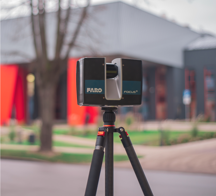
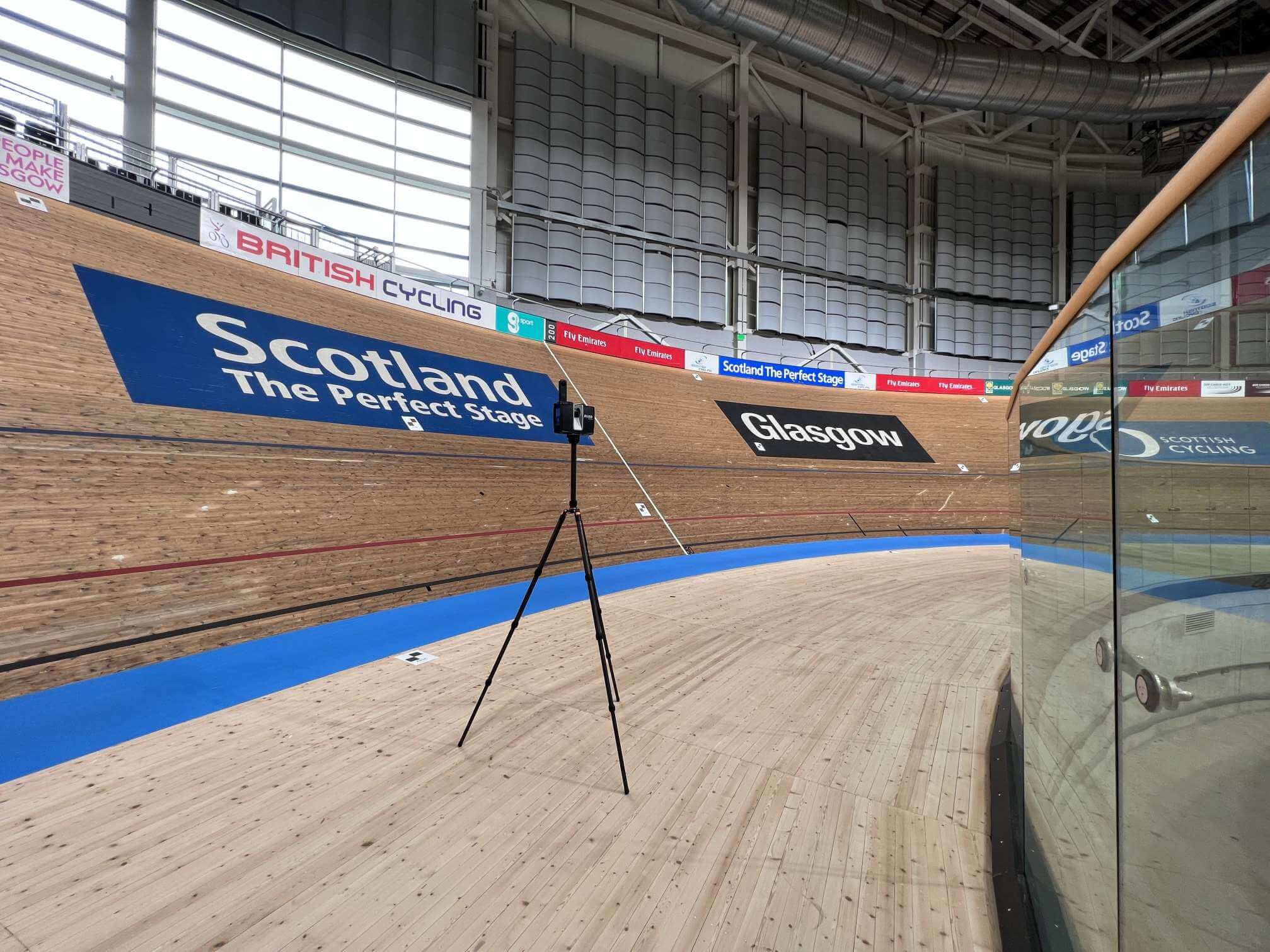
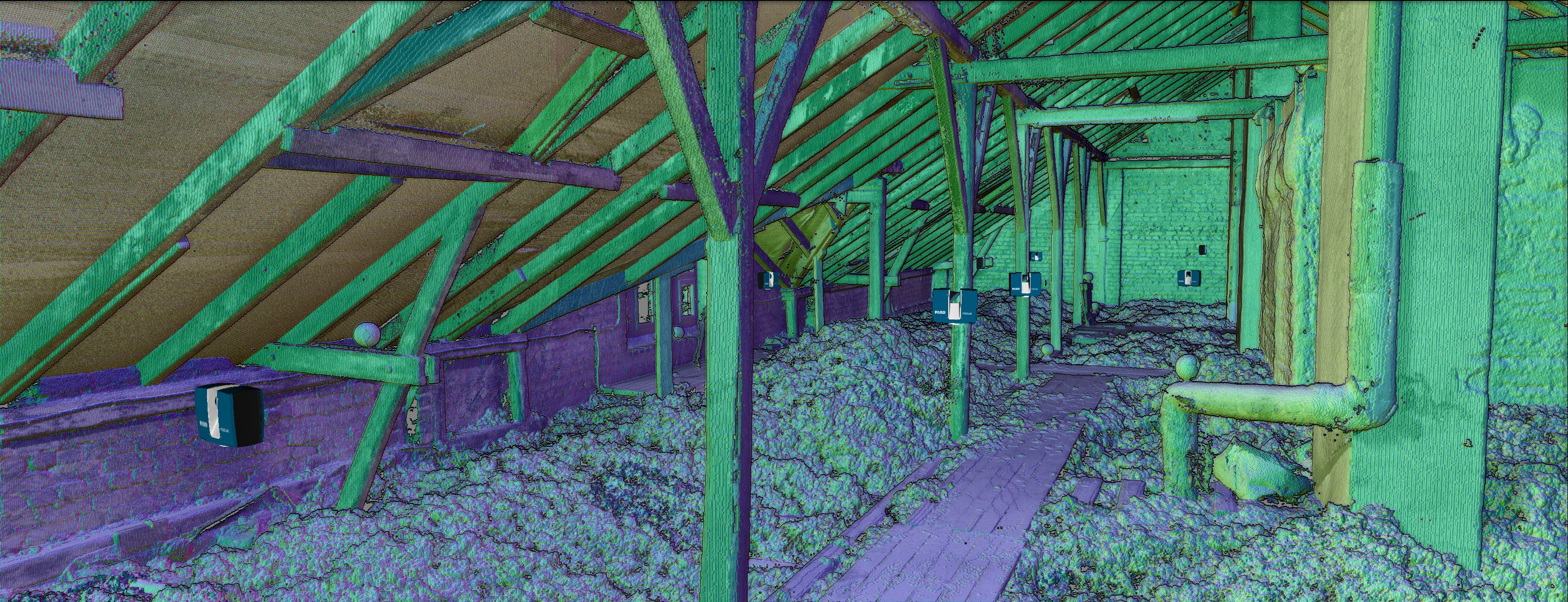
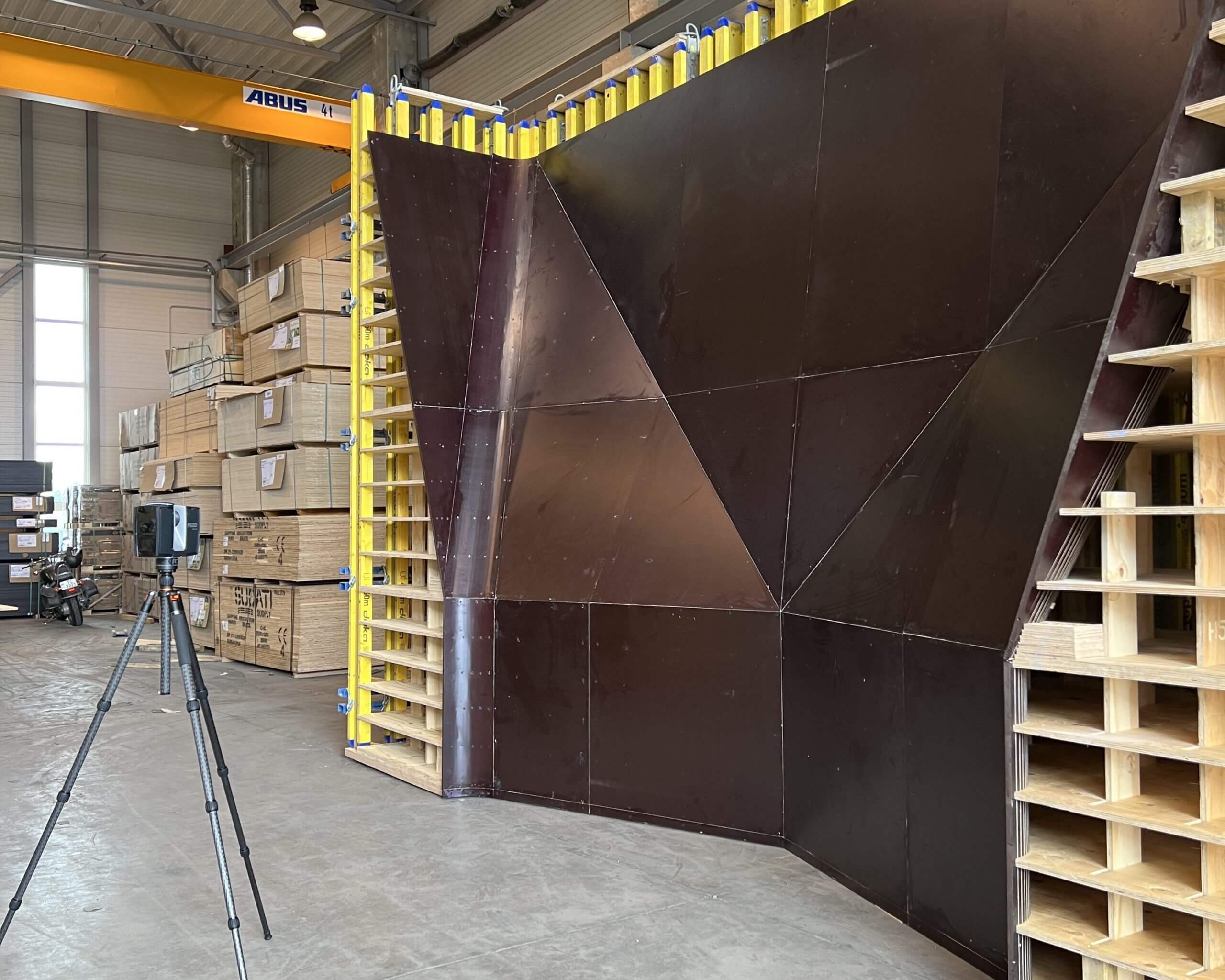
3D laser scanning
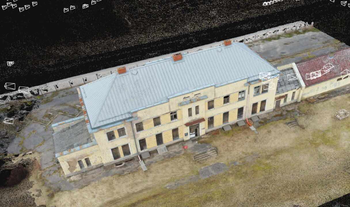
3D laser scanning allows precise measurements of an object to be taken in a very short time, which, when transferred to the digital environment, can be used to create a fully accurate 3D model of the object. The model can then be processed and used as the customer requires.
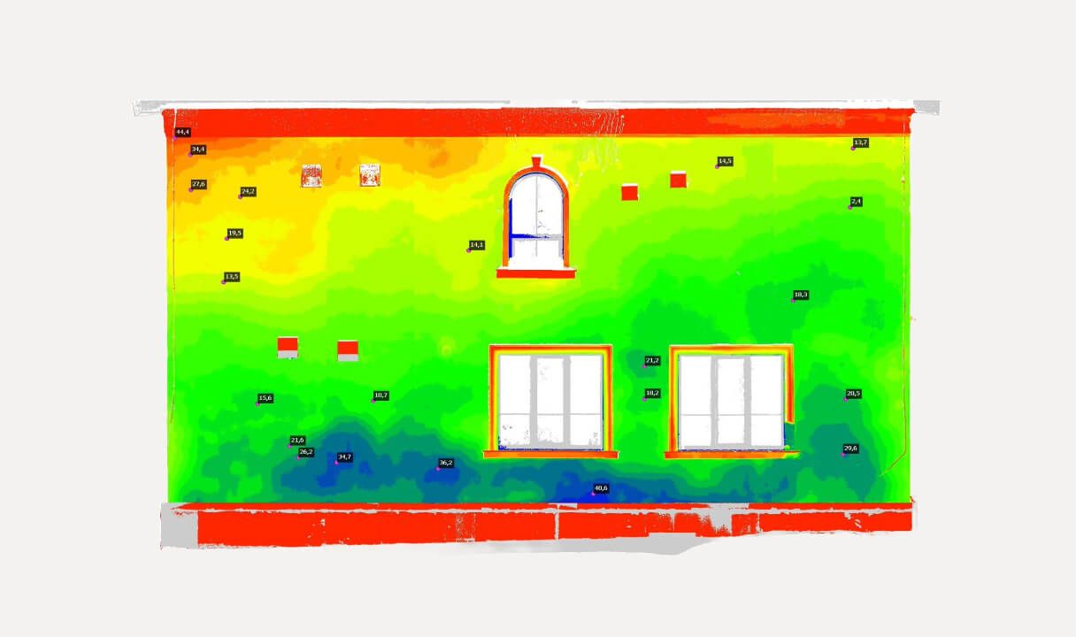
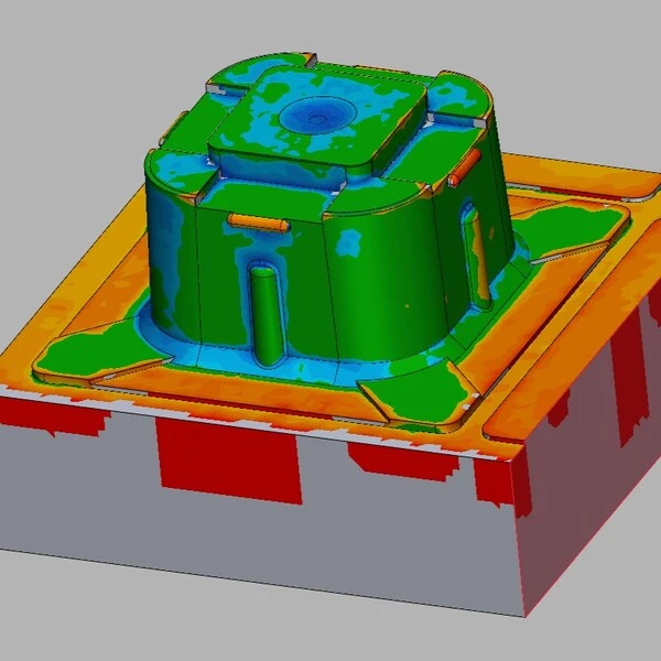
Deformation analysis
Deformation analysis allows the identification of deficiencies in the object before it is completed and their timely correction. It is used in construction, engineering, manufacturing and elsewhere to determine whether structures have changed due to various factors.
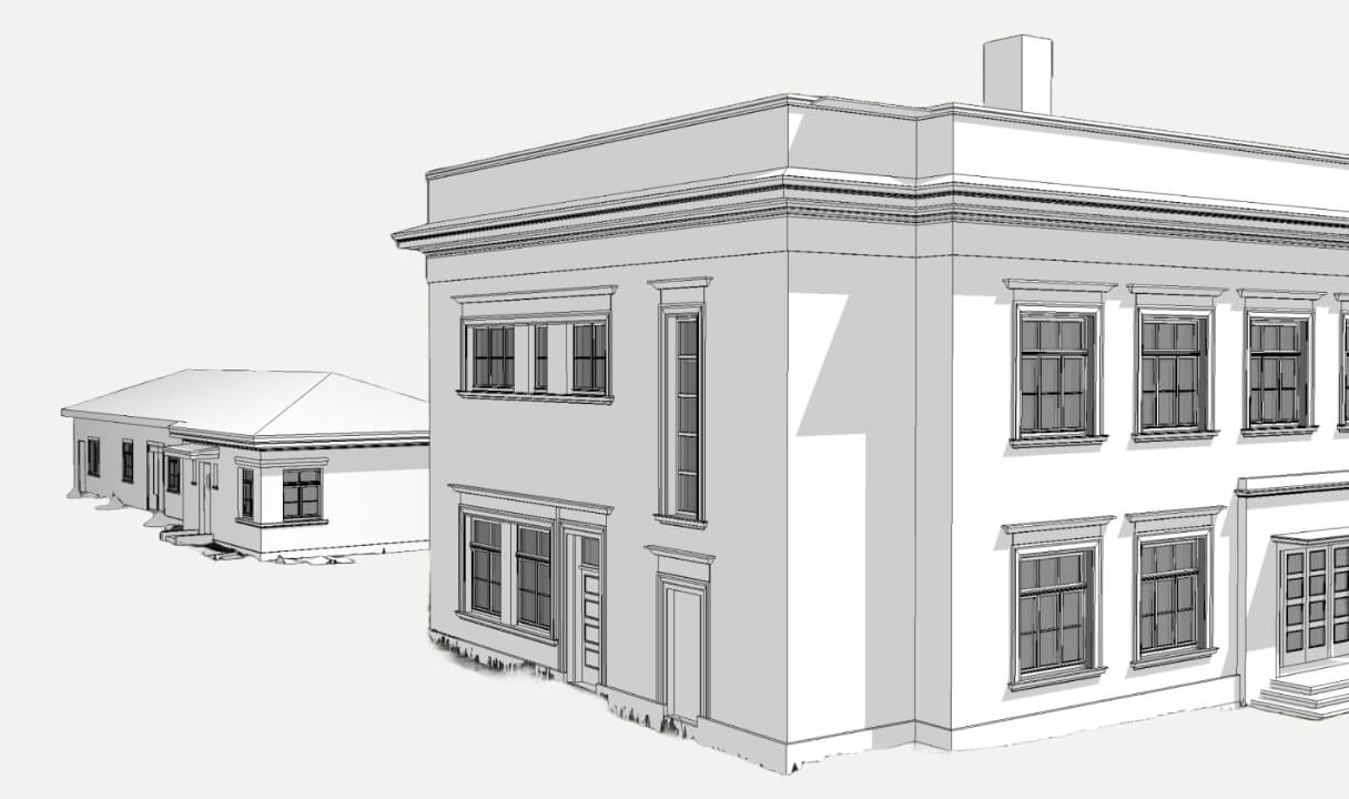
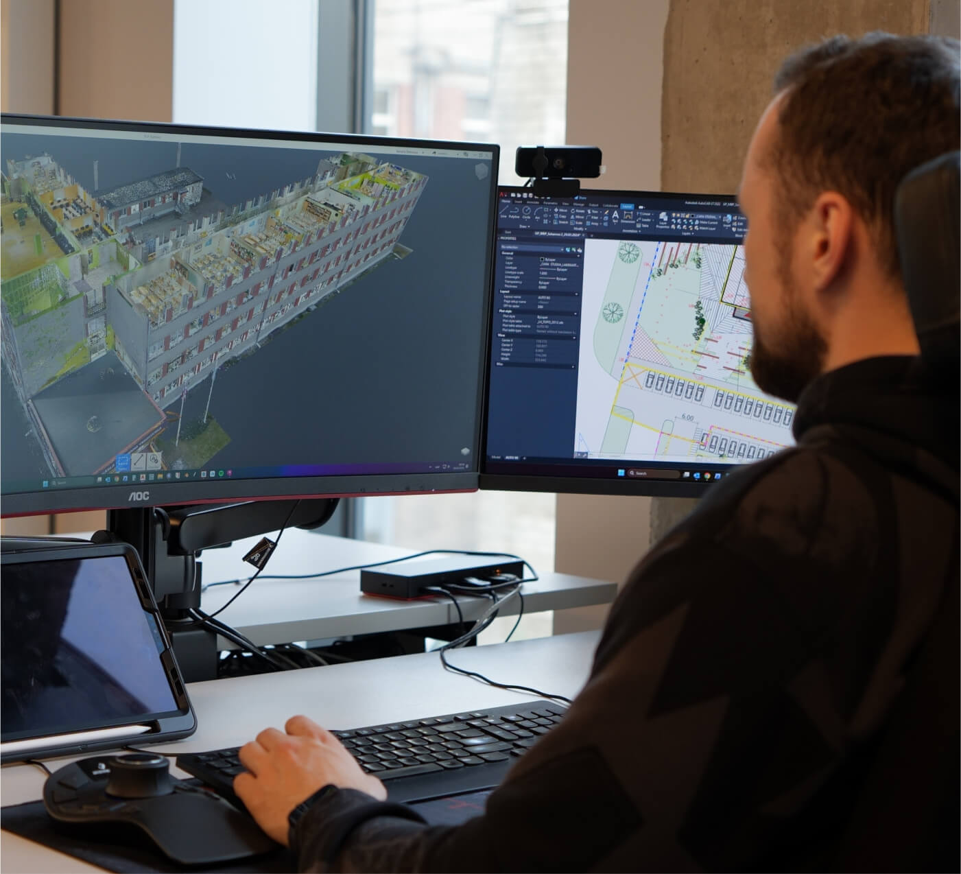
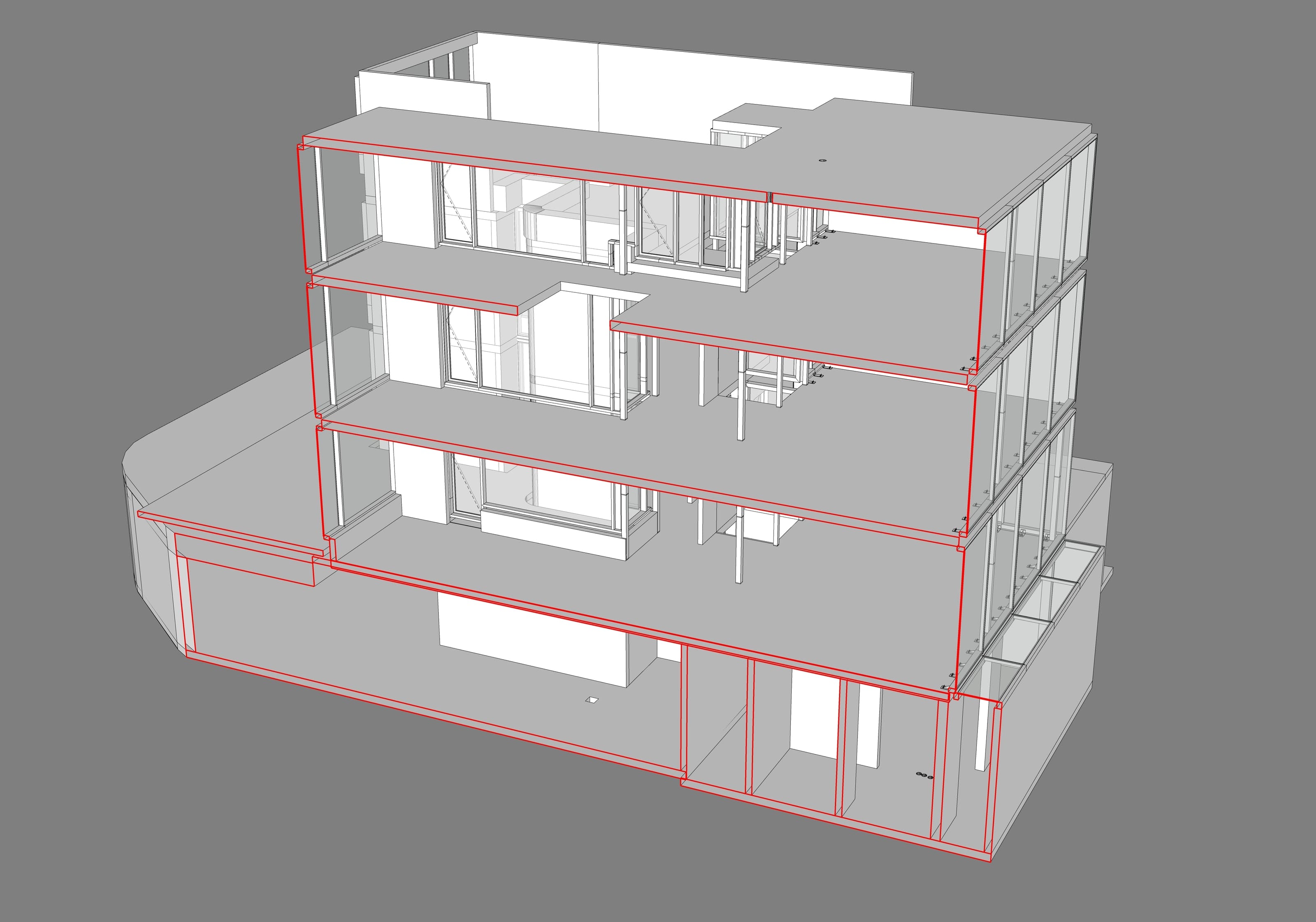
3D modelling
3D modelling allows you to create accurate 1:1 models of the real object. The models are then often used in construction, architecture and other applications to speed up project progress and eliminate potential defects.
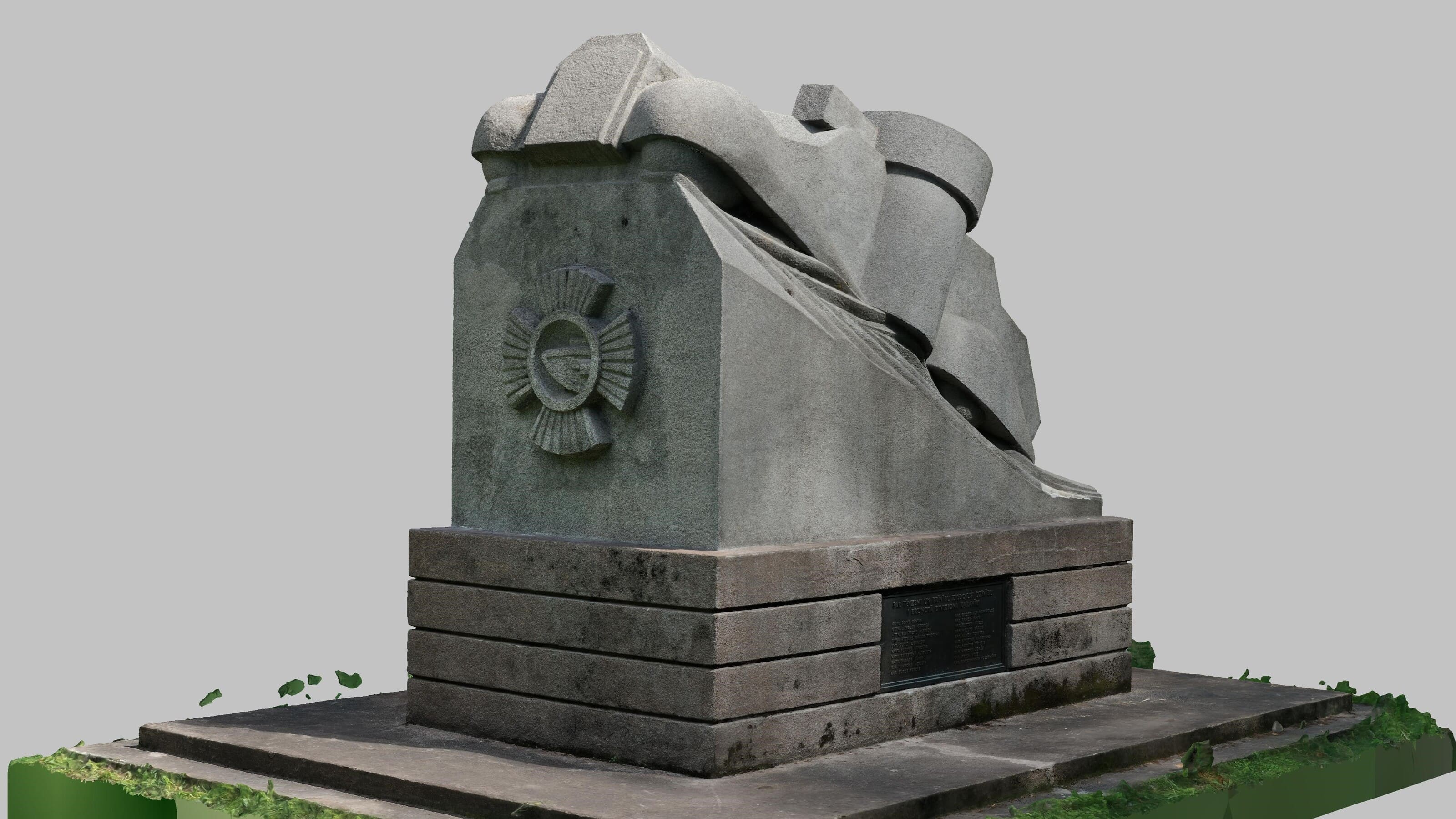
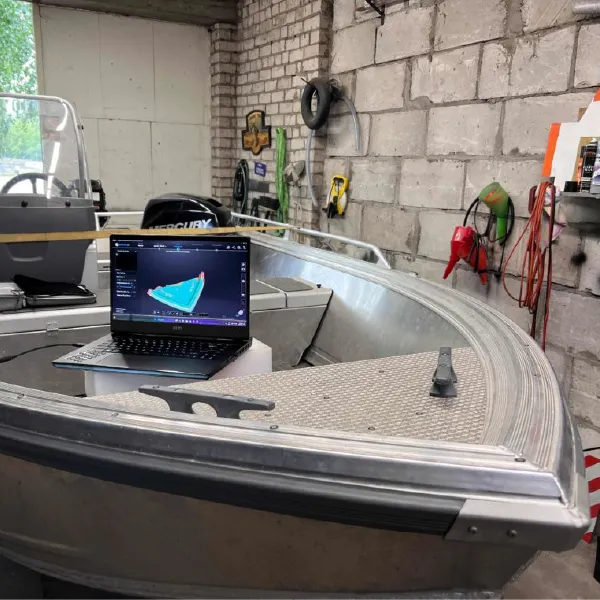
Photogrammetry
Photogrammetry uses hundreds to thousands of photographs from different angles, which are then combined together to create a 3D model. A drone is used to capture an object from the air, or an ultra-high-resolution camera is used to capture it on the ground.
360 virtual tours
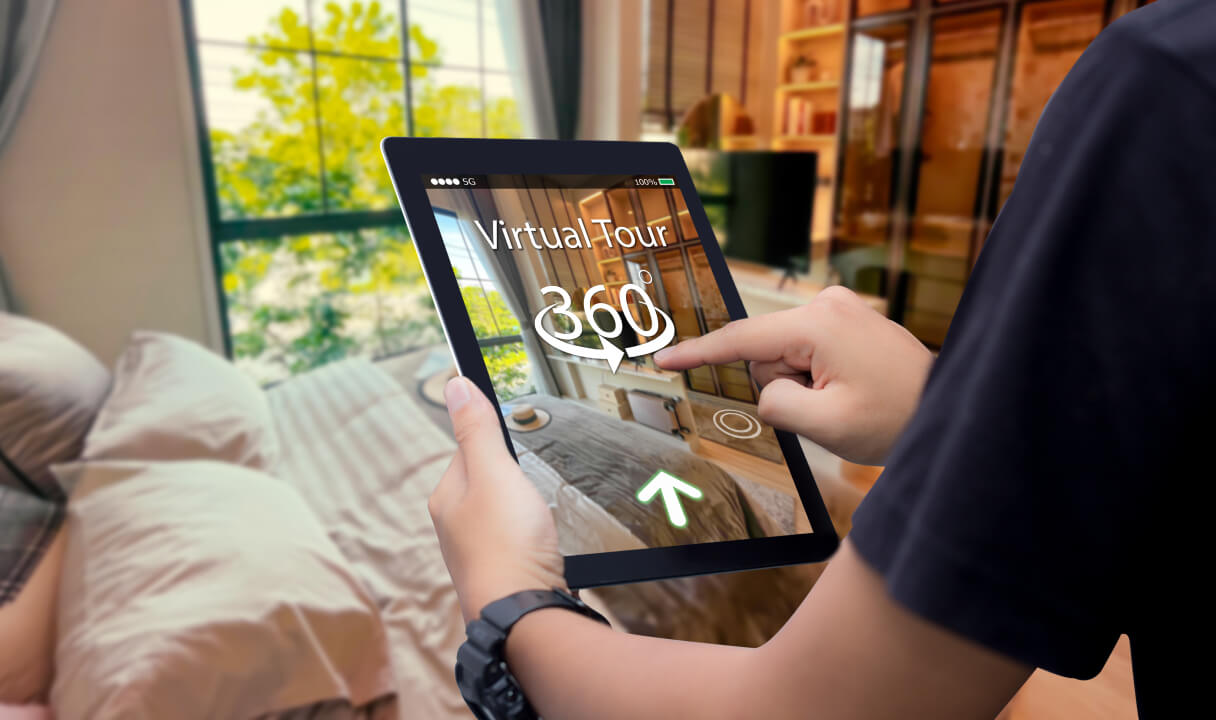
360 virtual tours are a way to explore places remotely. It is a video representation of a physical place that the user can control just like in a computer game - moving around and looking around just like in real life. Such tours are used in marketing, presentations, education and more.
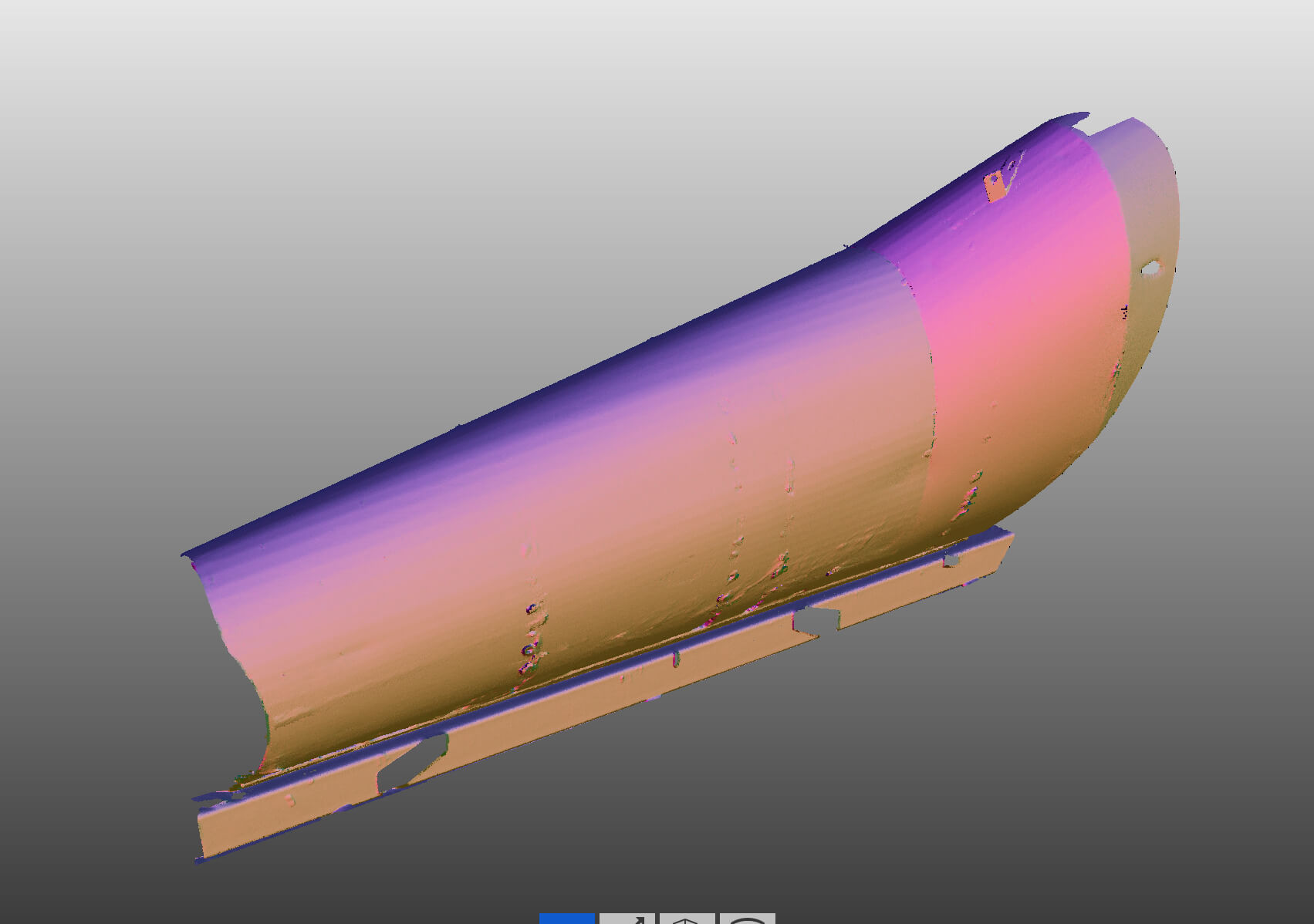
Reverse engineering
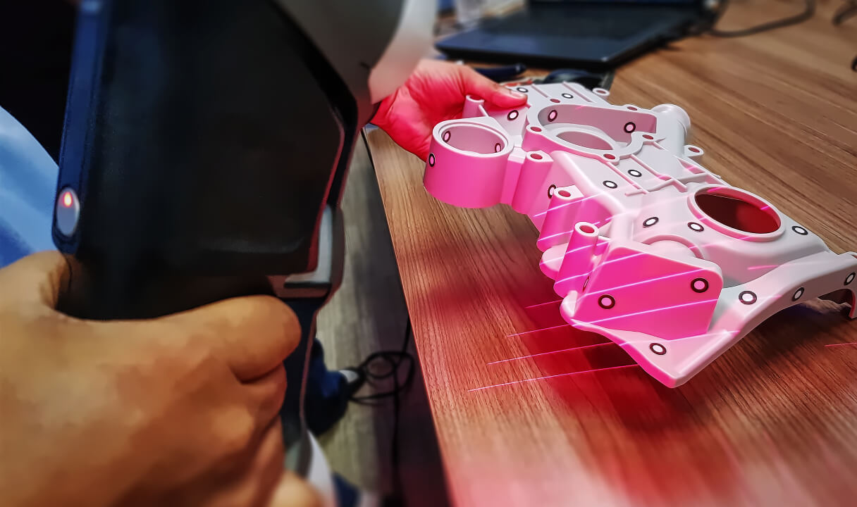
Using reverse engineering, we can obtain an accurate three-dimensional model even if the physical scan is incomplete. Reverse engineering is used to understand and document existing products, make improvements or reproduce them in a virtual environment.
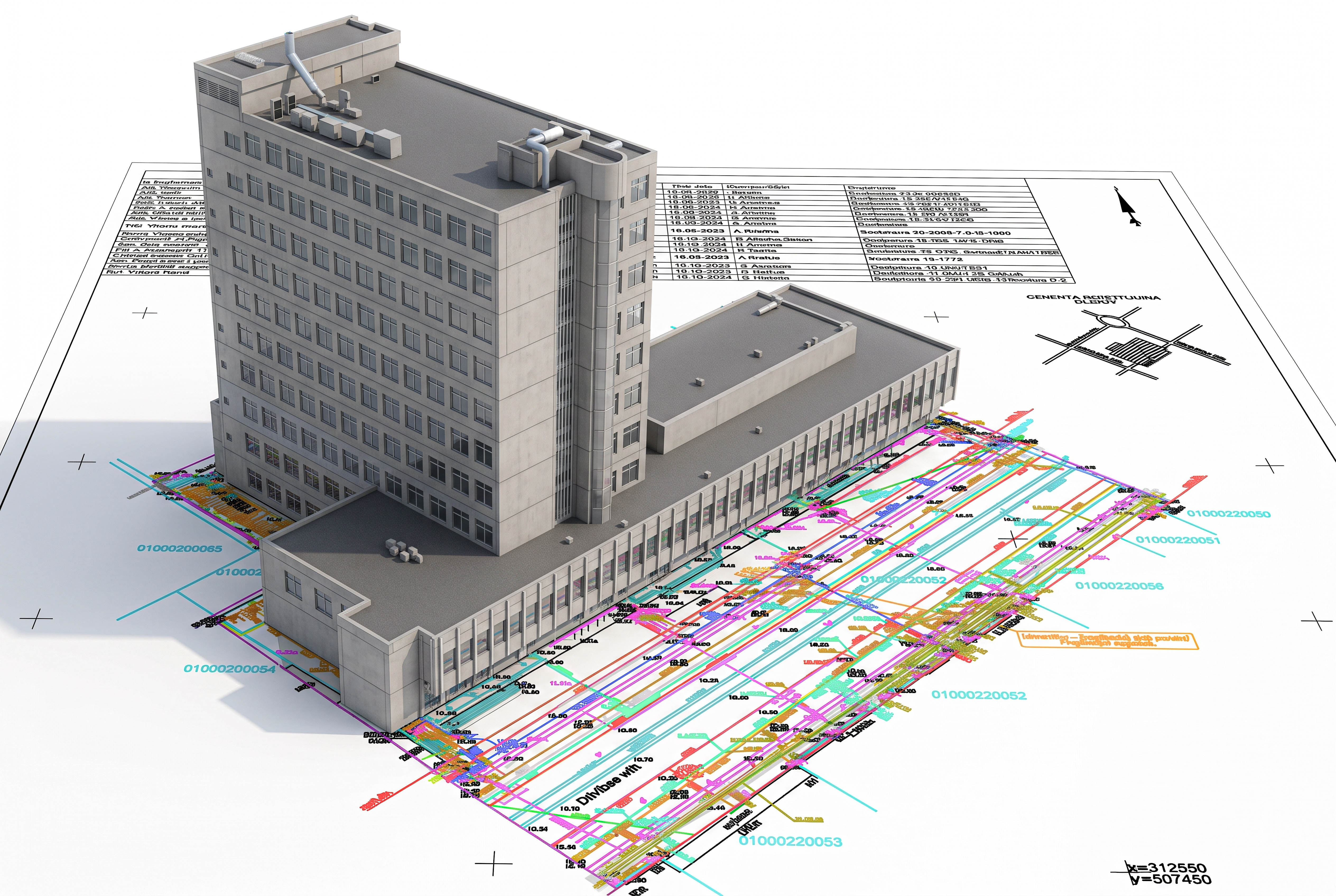
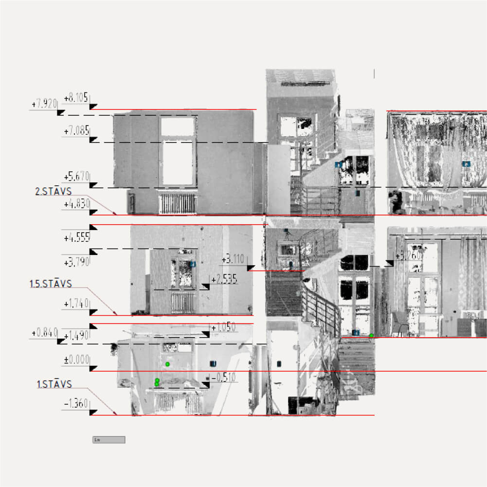
2D technical drawings
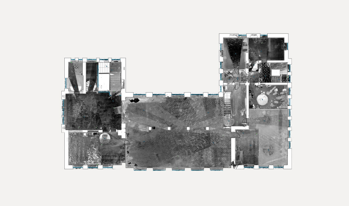
We offer the creation of 2D drawings from 3D models. 2D drawings can be used to show detailed measurements, various planes and views, as well as the project specification. This method is widely used in architecture to represent building plans and sections.
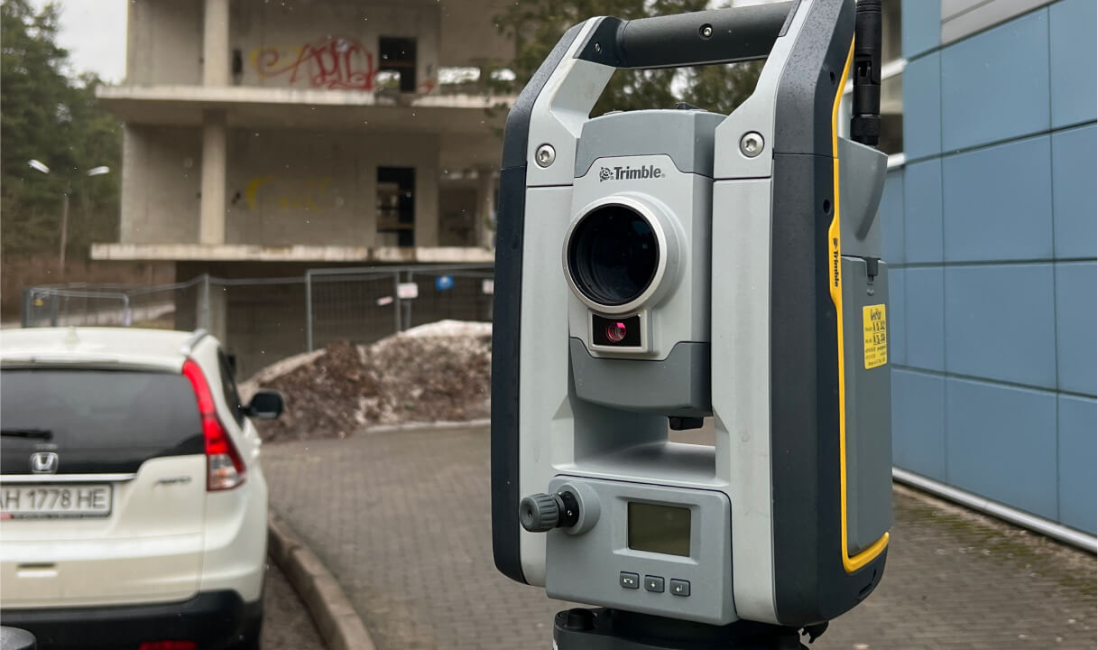
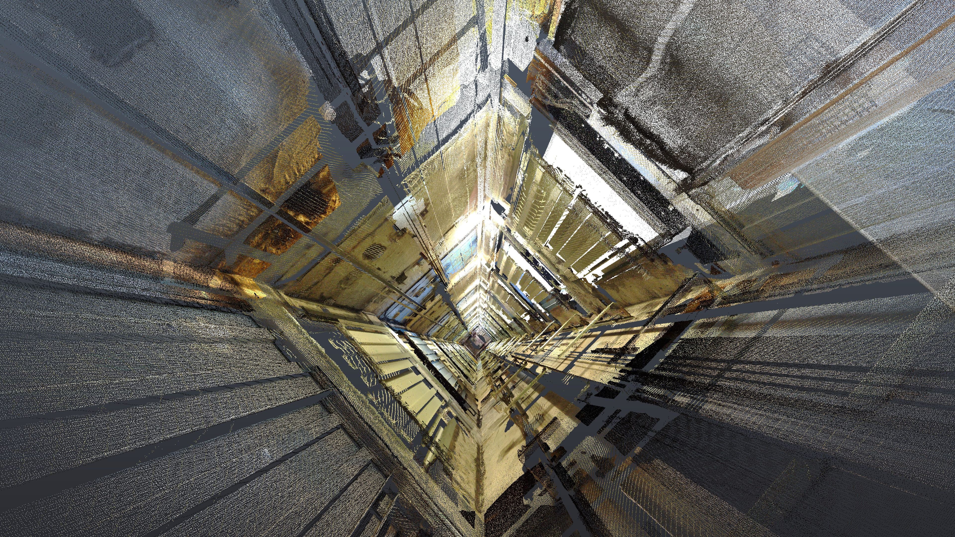
Surveying
Surveying is the discipline of measuring and mapping the earth's surface and other natural or man-made objects. It is widely used in various industries such as construction and engineering, land administration and others.
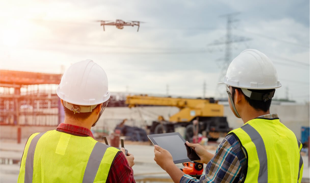
Aerial surveying
Aerial surveys can be used to produce accurate 3D models over large areas. The drone scans the area or takes photos. Aerial surveying is widely used in mapping and topography, geodesy, urban planning and development, and more.
What is Tekto?
Tekto is a company with more than 8 years of experience in 3D scanning, 3D modelling and BIM (Building Information Modelling) solutions.
We offer our services to various industries – construction, road building, architecture, design, manufacturing, etc. – as well as to building managers who care about the condition and safety of buildings. We also work with individual clients who need a modern and fast solution for technically complex projects.
Our team is characterised by professionalism, curiosity, experience and the ability to deliver the best results for our clients. We actively follow new developments in the industry and integrate the latest methods and technologies into our work processes.
Why work with us?
Our extensive and long-standing experience in 3D solutions provides an excellent basis for accurate and high-quality services. We are keen to explore and apply unprecedented solutions, so we say "yes!" also for unusual projects. We make sure our customers are always satisfied and receive the very best.

8 year experience
Years of experience means knowing how to do a project best and most efficiently.

Latest technology
We work with the latest generation of 3D scanning technologies and software.

Fast execution
Experience and the latest technology ensure fast and accurate work.

Individual approach
We find the best solution for each specific project.
Completed projects
Let our work speak for us! Here are some of the projects we've completed.
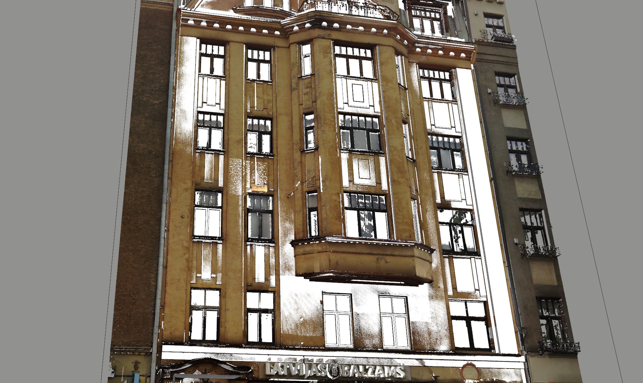
Riga Fashion – 3D model
More than 11,000 m², transformed into an accurate 3D model with LOD 300 detail – the result of our team’s dedication, experience and perseverance. This project was a test – with challenges that required both technical precision and the ability to adapt quickly. It is at times like these that the professionalism of the team […]
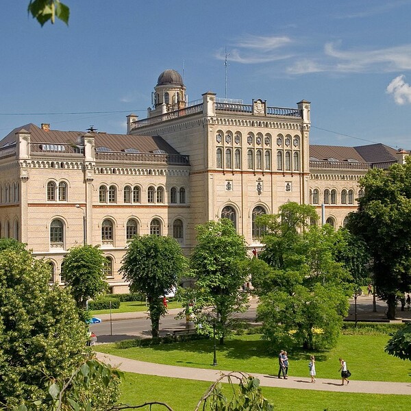
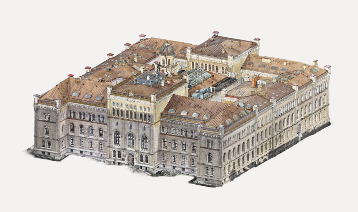
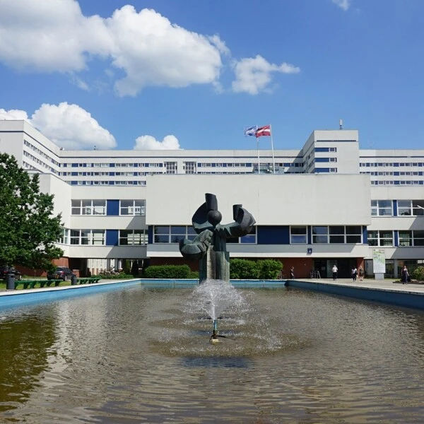
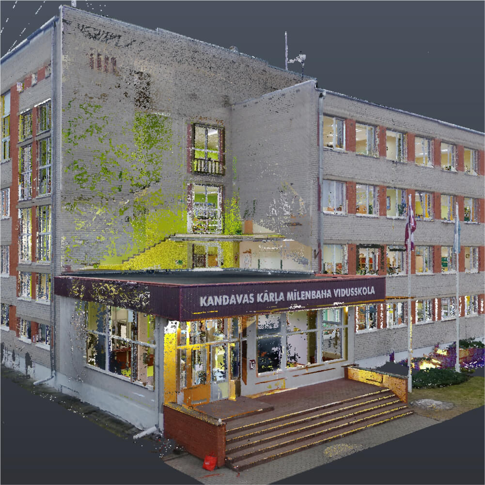
3D laser scanning of the University of Latvia’s interior and facade
Full 3D scanning of the central building of the University of Latvia, total scanning volume was ~15 000m2.
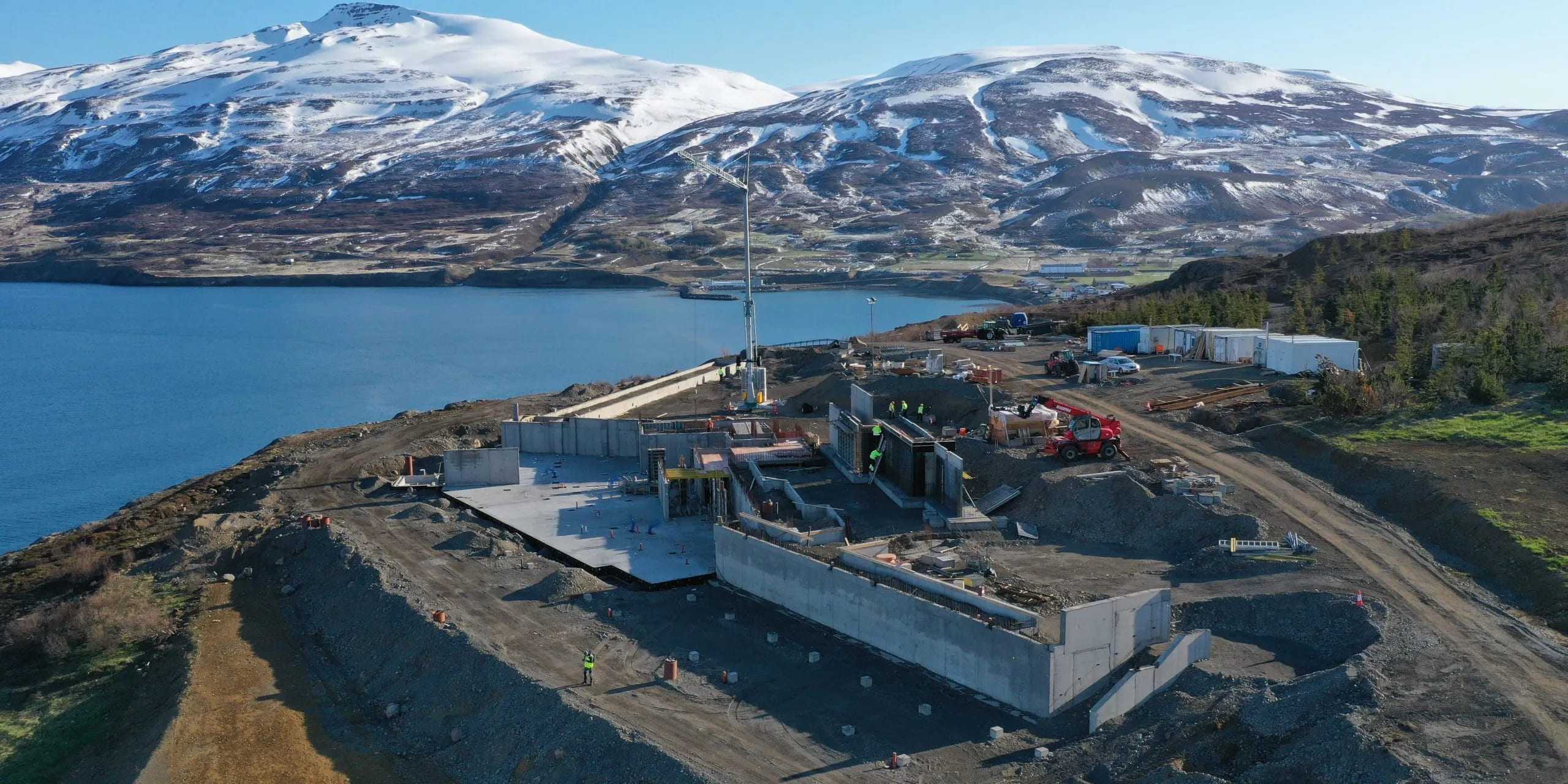
3D Laser Scanning at Hofdi Lodge Hotel, Iceland
3D laser scanning of a building for the construction of concrete structures for a hotel complex. The work was carried out to assess the compliance of the as-built volume with the design.
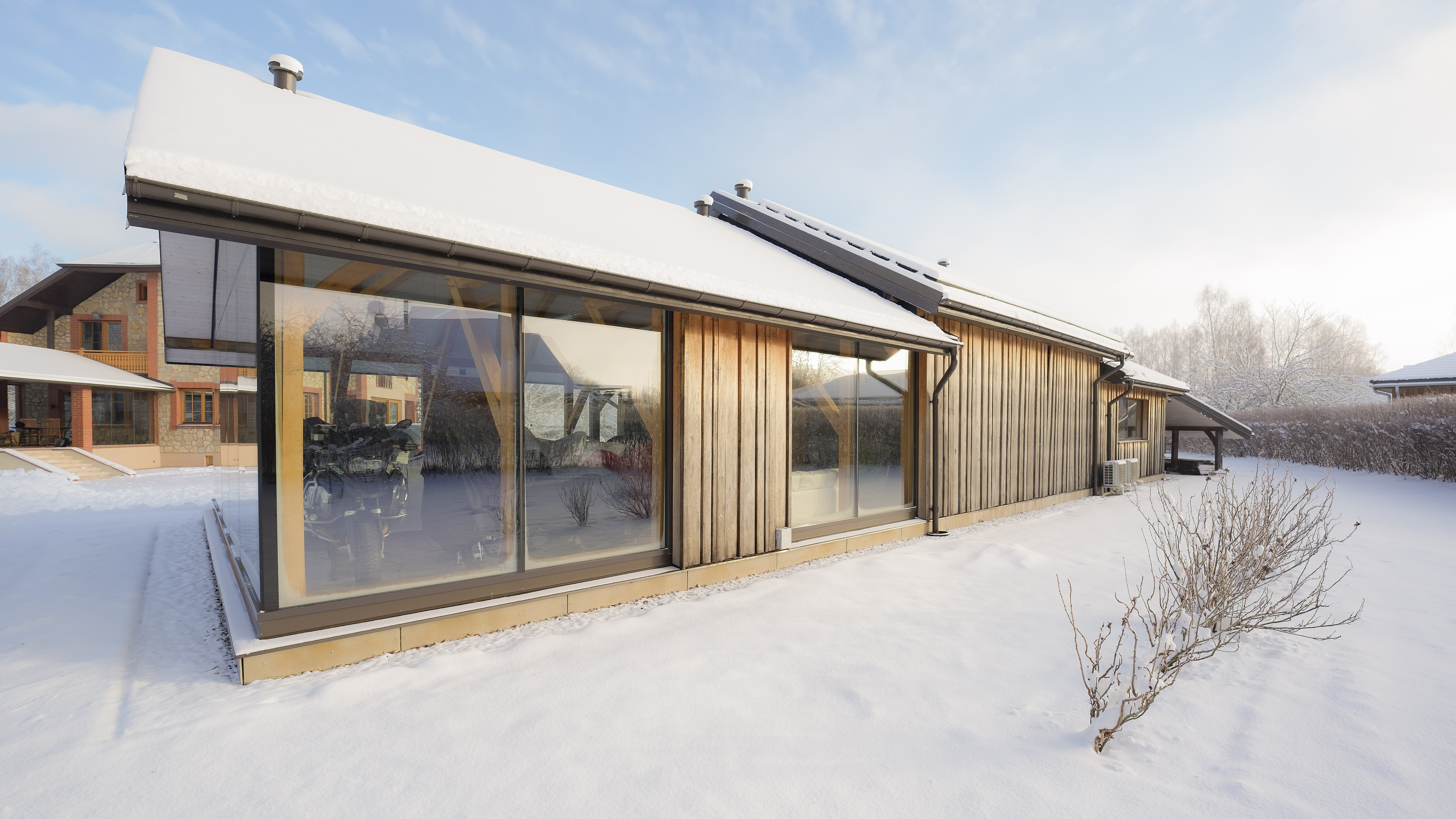
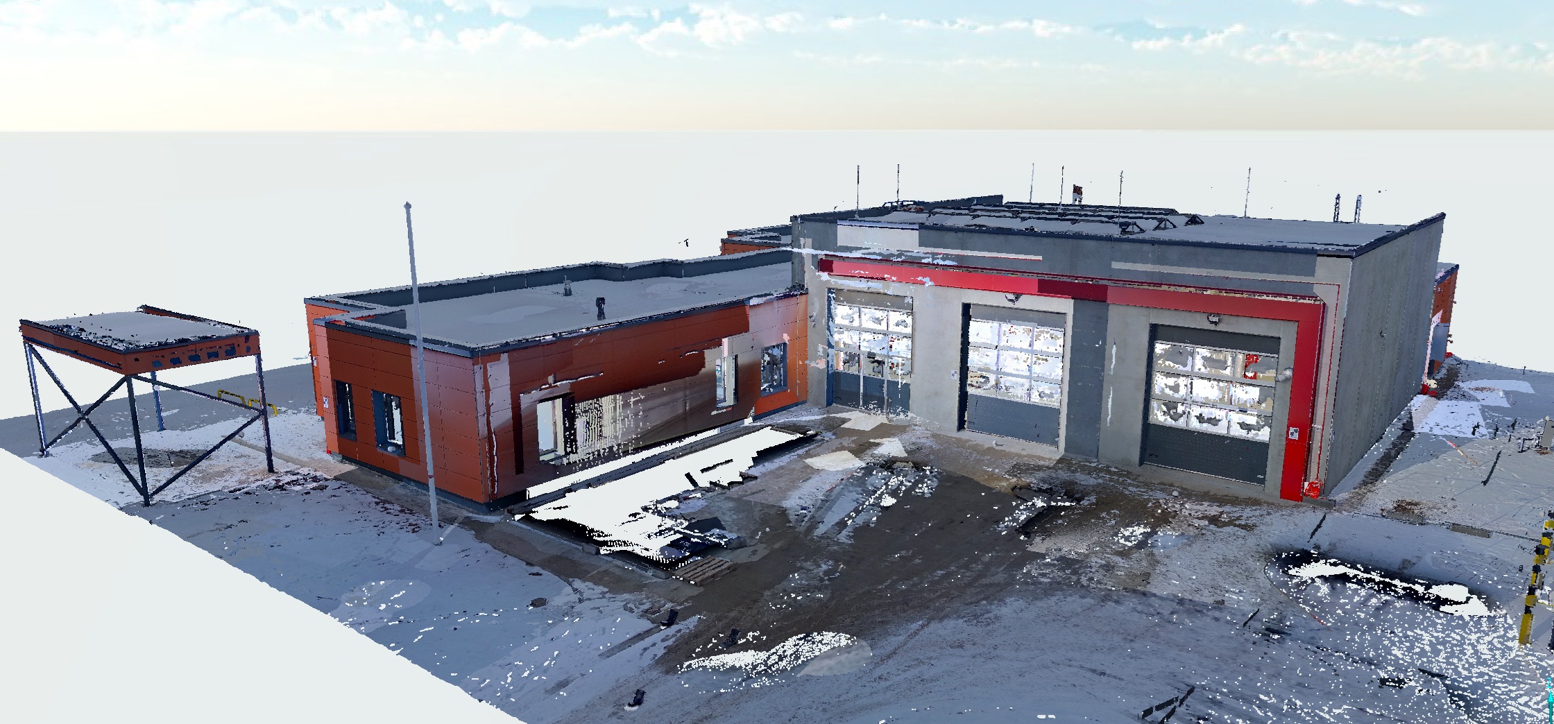
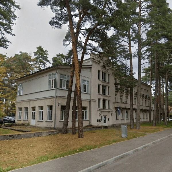
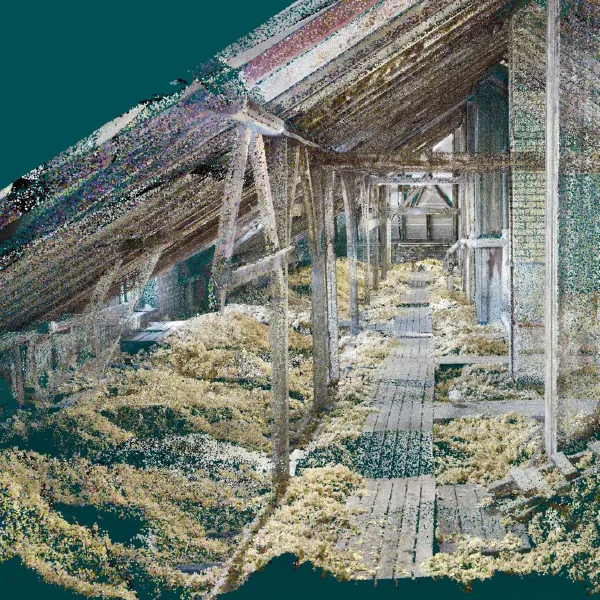
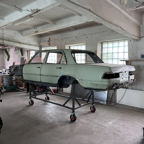
Farm house. Laser scanning and model preparation
The surveying process for such a building takes about 2 hours, fully surveying both inside and out. This is followed by processing and registration of the measurements, and finally a point cloud that can be used for design, 3D modeling, measurements, and other tasks that do not require re-surveying the building.
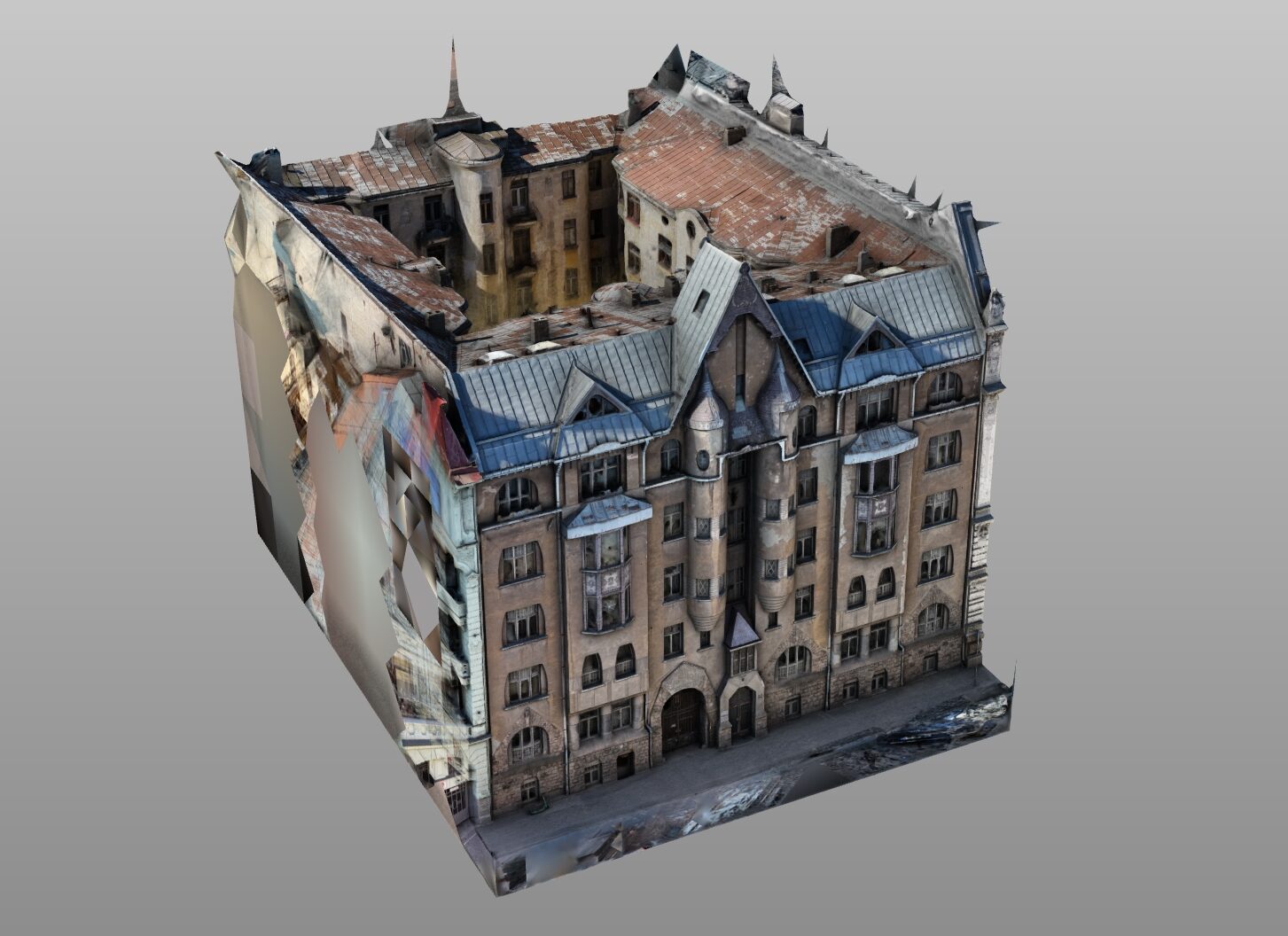
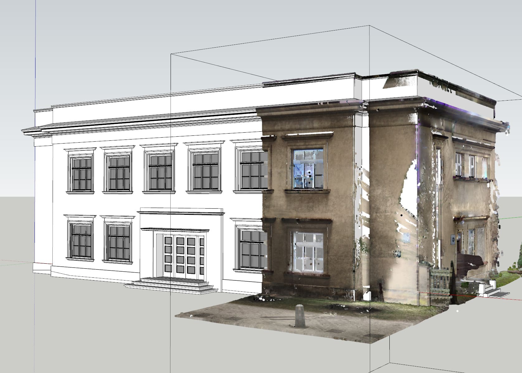
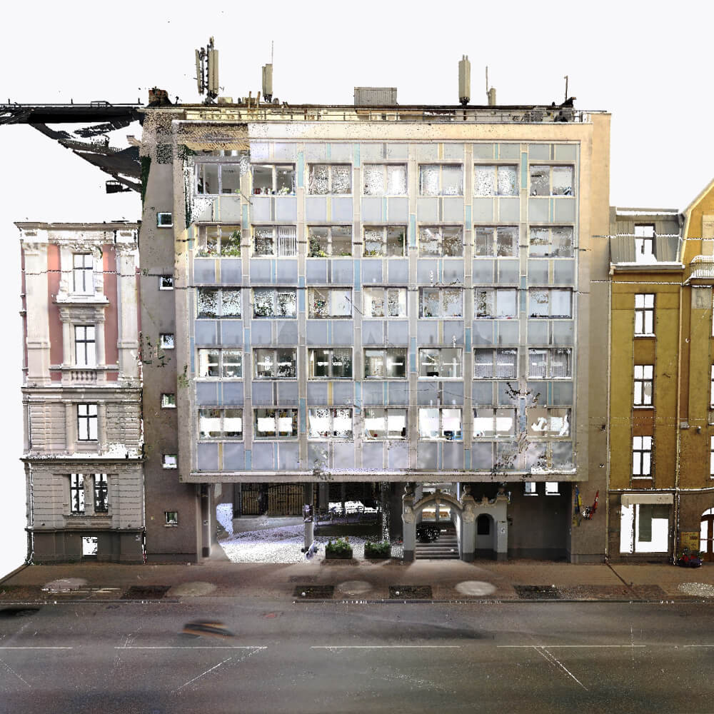
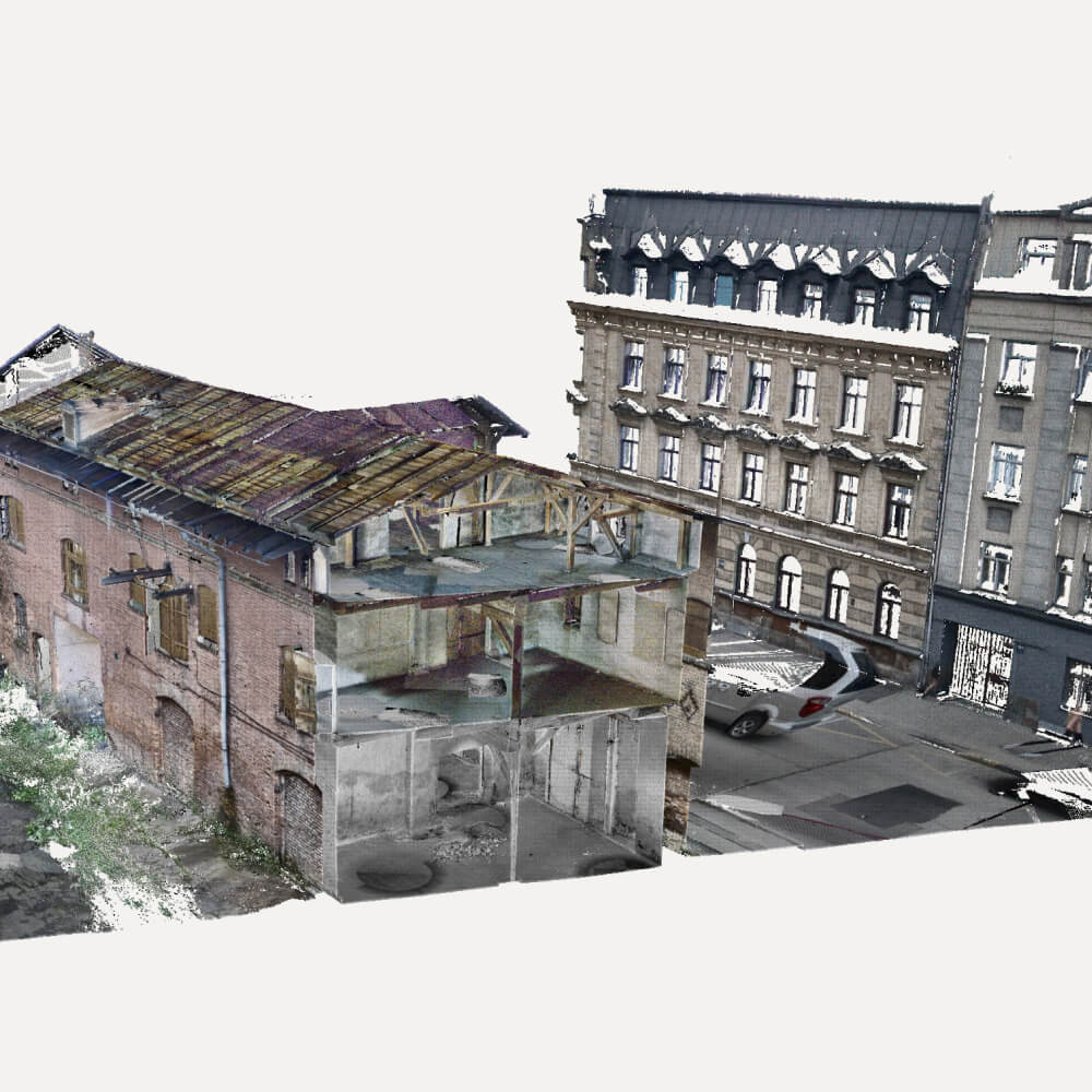
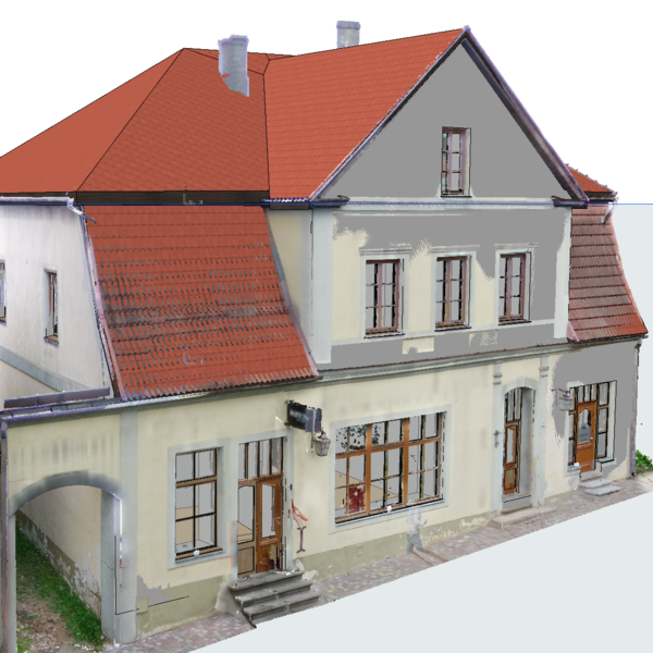
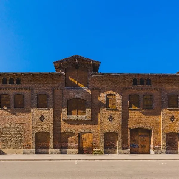
Mesh model of Alberta Street
Project description This project involved the digital survey and 3D modeling of the pre-war Riga city centre. The building is distinguished by its rich architecture – decorative bay windows, different window shapes and a complex roof structure. High-precision data was obtained using photogrammetry, which was used to create a detailed 3D mesh model with authentic […]
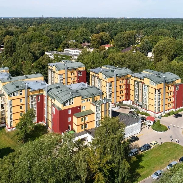
3D modelling of the Ogre postal quarter
Find out how we can help, book a consultation!
If you have any questions or would like to know more about our services, book a free consultation!